EDINA Geoforum 2014
I attended EDINA's Geoforum 2014, described as:
... a free all day event aimed at lecturers, researchers and support staff who promote and support the use of geo-services at their institution.
I came along primarily to learn more about the services that my own organisation, EDINA, provides in this space.
These are my notes from the day - I had to dip in and out of parts of the day to deal with other things so my notes are quite selective - my aim is to give a flavour of the day. For a more complete account, I recommend the impressively comprehensive 'live blog' post written by my colleague Nicola Osborne
Opening Keynote

The opening keynote was delivered by Peter Gibbs, BBC and Met Office forecaster and presenter, and proved to be an absorbing introduction to the various data services used in weather modelling and prediction, with a focus on hydrological aspects.
The Pitt Review, which was launched to examine the the flooding events in the UK in 2007, concluded that the Met Office and the Environment Agency should work more closely together. One outcome of this recommendation was the establishment of the Flood Forecasting Centre in Exeter. This has developed a new expertise, that of hydro-meteorology.
Peter suggested that one might think that weather forecasting ought to be simple. After all, we have well understood laws of physics and thermodynamics, and if the modelling and measurement is up to scratch then forecasting should be straightforward. Of course it isn't that simple. Chaos is the enemy of weather forecasting. Small variants in inputs to the data model may have an effect which multiplies over time.
This is mitigated by an approach called Ensemble forecasting, where the same same model is run many times over, with slight changes to the inputs at each iteration.
Peter talked about some of the methods used to collect data. For example, nearly all commercial aircraft are instrumented to automatically collected temperature, air-pressure and wind-speed data and to share this through a satellite network. This is valuable - but it does mean that this data collection is concentrated over the developed world, and in the northern hemisphere, where the majority of commercial air-traffic is found.

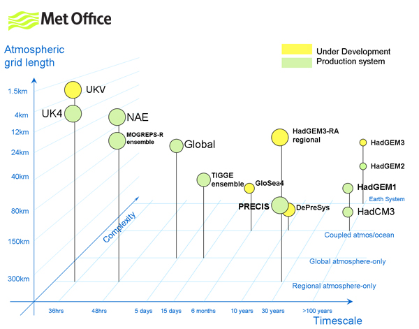
Data collected can vary in quality and quantity in other ways. For example, some image data is collected using a series of satellites in orbit over the equator. This means that the resolution of images of equatorial regions is superior to that of images of locations in higher latitudes. The quantity of data available for processing is huge, with processing and modelling meteorological data requiring super computers. The Met Office has been at the forefront of this kind of activity for some time, with the US having fallen way behind due to lack of funding. In response to the challenge of the quantity of data to be processed, a unified model is now typically used for modelling at every level - so both global and localised data can be used to inform the same models, and one model can be 'nested' inside another.
There was plenty more of interest in Peter's talk - I recommend a look at the slides.
Geoservices Support
Carole Blackwood, EDINA
Carole gave an informative account of recent developments with EDINA's 'geoservices' and a preview of up and coming new features.

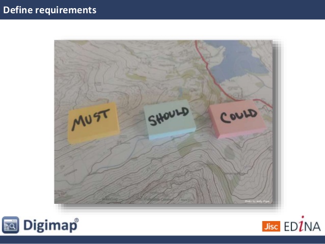
EDINA has adopted the approach of working through user-stories to plan feature development for Digimap, classifying potential new feature developments as things which must, should or could be done.
User support for Digimap is excellent, with a variety of learning and teaching resources having been developed by the team and made publicly available. Some of these resources are designed to be re-usable, so that teaching staff in Digimap's subscribing institutions can take these materials and tailor them for their own students' needs. Screen-casts, showing how to use various parts of the Digimap suite of services, have been recorded and published on Youtube. For those who need closer support, there is even a real-time *chat with the Digimap team' function. In addition to all the online support, Carole explained how the Digimap team "like to get out and about", delivering training and support workshops to users (this prompted a comment from a delegate about how "completely fantastic" the tailored workshop from EDINA staff was for her masters students).
Up-and-coming events which EDINA's Geoservices Team are either delivering or attending
Carole's slides are available on Slideshare
Field Trip GB
Addy Pope, EDINA

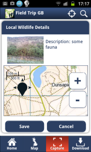
Addy led an exercise which saw a 20-30 delegates all using a recent innovation from EDINA - a smart-phone application called Fieldtrip GB to go out in to 'the field' (i.e. the street outside!), to collect images of and metadata about graffiti. This worked well as an introduction to Fieldtrip GB, which is a free tool designed to allow users to design forms which they can then use to collect data against high quality maps. Map caching means that the app can even be used off-line.
EDINA believes that this app is unique in the sense that it:
- allows the flexible and user-configurable collection of data
- works off-line
- has good quality mapping
- is free to download and use!
Currently the maps used in Fieldtrip GB are restricted to the UK - however the next version will be able to use Open Street Map as an alternative offering global coverage.
EDINA makes the source code to Fieldtrip GB freely available on its GitHub space
Summing up
Unfortunately, I had to leave the event shortly before the end so I missed the conclusion. Although I joined the organisation a few months ago, such is the depth and range of activities at EDINA that I'm still learning about them. This event was an excellent opportunity to learn more about EDINA's geoservices.
To find out more about EDINA's geoservices, visit the EDINA website's 'Maps & Data' page.